
But Florence will make its mark, as the remnants of the storm unleash heavy rain, downpours, some thunderstorms and the risk of flash flooding.
The storm has now resulted in 32 deaths, up to 40 inches of rain in some spots, trapped hundreds, knocked out power to more than a half-million homes and businesses and made hundreds of roads in North and South Carolina impassable.
Showers and thunderstorms will produce periods of heavy rain in the region on Tuesday, according to the National Weather Service.
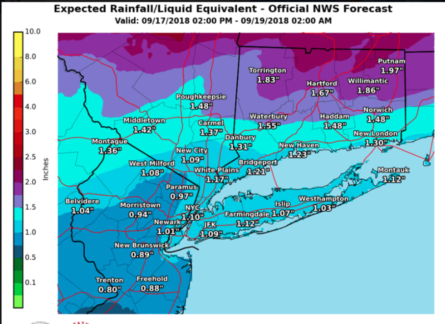
Rainfall rates in excess of one inch per hour will be possible at times, with storm total rainfall ranging from 1 to 2 inches with locally higher amounts. Areas of minor flooding are likely. There is also an isolated flash flood threat where the heaviest rainfall occurs.
A look at projected rainfall amounts through Wednesday morning appears in the first image above.
A Flash Flood Watch is now in effect for much of upstate New York (including Dutchess) and upstate Connecticut until 2 a.m. Wednesday. (See second image above.)
The showers and storms will continue throughout the day Tuesday, which will see a high temperature in the upper-70s. Storm and shower activity will wrap up by around 11 p.m. Tuesday.
Wednesday will be sunny and pleasant with a high in the mid-70s.
Check back to Daily Voice for updates.
Click here to follow Daily Voice New Rochelle and receive free news updates.