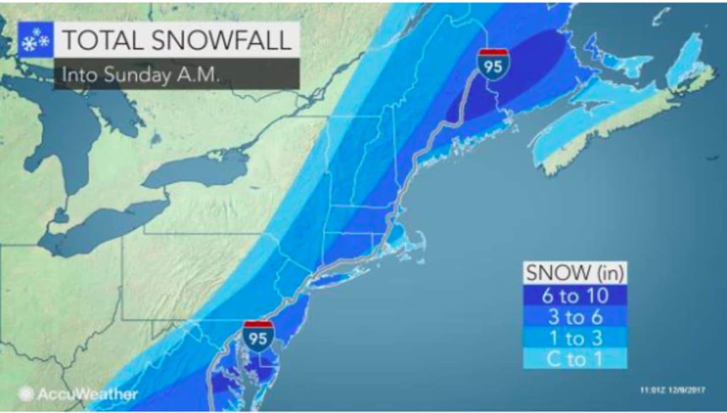
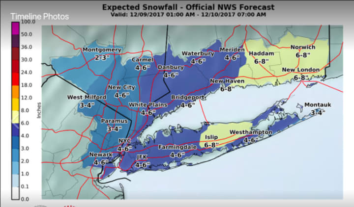
Most of the region should see about 3 inches of accumulation, with higher amounts possible farther east. For updated projections from both AccuWeather.com and the National Weather Service, check the two images above.
A Winter Weather Advisory is in effect for the tristate area from early Saturday morning to early Sunday morning.
The snow will also cling to trees, according to AccuWeather.com, which notes that since some of the trees are holding onto leaves, some tree limbs may bend or break and cause sporadic power outages. Widespread outages are not anticipated since wind speed is only expected to be between 5 and 11 miles per hour.
Motorists should anticipate slippery roads with “significant reductions in visibility at times with accumulation on pavement more likely in the afternoon and evening," according to the National Weather Service.
Saturday will be brisk with a daytime high around the freezing mark and the wind-chill factor between 20 and 25 degrees.
Snowfall should begin sometime in the mid to late morning Saturday and taper off by midnight.
Sunday will be mostly sunny with a high in the mid-30s.
Check back to Daily Voice for updates.
Click here to follow Daily Voice New Rochelle and receive free news updates.